King George III’s massive collection of military maps, views and prints forms a key part of the Royal Collection and to mark the 200th anniversary of the King’s death, more than 3,000 of which have been published online.
The publication of the selection from the more than 55,000 items in the collection marks the culmination of 10 years of research by Dr Yolande Hodson who has catalogued the contents of the collection which dates from the 16th to the 18th centuries and provides a contemporary account of theatres of war in Britain, Europe and America.
The collection includes everything from so-called “presentation maps” of sieges, battles and marches to rough sketches drawn in the field, depictions of uniforms and fortification plans.
Highlights include two-metre-wide maps of the American War of Independence (1775–83) which designed to hang on purpose-made mahogany stands in Buckingham House – among them is a map of the final British defeat at the Battle of Yorktown in 1781, the only known copy to survive outside the US.
There’s also a memorandum written by Scottish military engineer William Roy to the king in 1766 in which Roy proposes a national survey of Britain based on his map and survey experience during the Seven Years War (1756–63) – it’s regarded as the founding document of the Ordnance Survey.
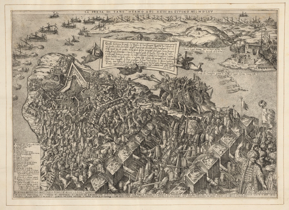
And there’s a rare engraving of the Siege of Malta (1565) showing how the Fort of St Elmo was overrun Turkish forces, resulting in the death of 1,300 Christian knights, captains and soldiers (pictured).
The collection can be found at militarymaps.rct.uk.
PICTURE: Matteo Perez d’Aleccio, A view of the Turkish assault on the Fort of St Elmo, Malta, on 23 June 1565. From the collection of Cassiano dal Pozzo. (Royal Collection Trust / © Her Majesty Queen Elizabeth II 2020)

