This east London district was recorded as far back as the 13th century when it was a rural area. The name comes from the obvious – it was located on the old London to Colchester Road about a mile east of Aldgate.
Its location so close to London – and the fact it was common land – meant Mile End was favoured as a recreational space by Londoners eager to escape the confines of the city.
It was here in 1381 that Jack Straw camped with the men from Essex during the Peasant’s Revolt and it was here that, even as Was Tyler and his men murdered Simon of Sudbury in the Tower of London, King Richard II famously met with the leaders of the revolt.
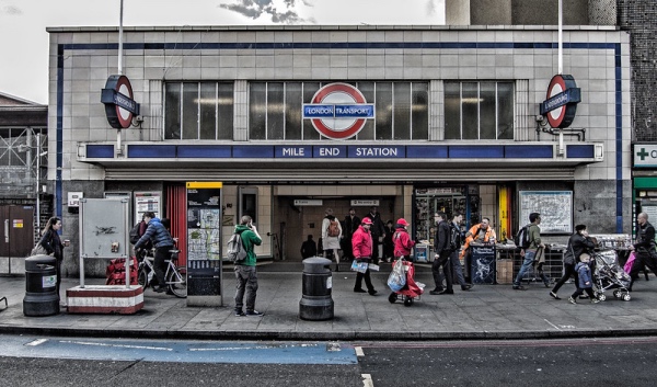
The area, which became known as Mile End Old Town (an unconnected area to the west was known as Mile End New Town), was gradually developed from the 16th century and attracted working class housing and, thanks to its affordability, a relatively high number of immigrants. The Mile End Tube station opened in 1902.
The area suffered in the Blitz during World War II and the first V-1 flying bomb to hit the city landed next to the Grove Road railway bridge on 13th June, 1944, killing eight civilians and injuring 30.
Famous figures connected to Mile End include explorer Captain James Cook, who lived in a now demolished house on Mile End Road between 1764-76.
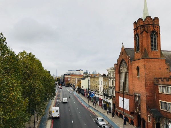
Landmarks include the Trinity Almshouses (built in 1695, they’re the last survivors of several almshouses built in the area) and the Frederick Arthur Walters-designed Guardian Angels Roman Catholic Church which was built 1903 by Henry Fitzalan-Howard, 15th Duke of Norfolk, as a memorial to his youngest sister, Lady Margaret Howard.
The People’s Palace – a five acre entertainment and educational facility which included a library, swimming pool, gym and winter garden – was completed in 1892 on Mile End Road. Destroyed by fire in 1931, it was rebuilt but finally closed in 1954.
The two halves of the 79 acre linear Mile End Park, which bisected by Mile End Road, is joined by The Green Bridge over the road.
PICTURES: Top – Mile End Road featuring The Guardian Angels Catholic Church on the right and Mile End Park on the left (Matt Brown /licensed under CC BY 2.0); Below – Mile End Tube Station (Chris Jones/licensed under CC BY-NC 2.0)