LondonLife – Docklands colour…
Though they no longer in evidence, this Thames-side East London district takes its name from the Black Poplar trees which were once abundant in the area.
The area was apparently fertile ground for the poplars thanks to the proximity of the Lea and Thames Rivers which created the moist soil the tree needs. There was still a poplar tree in the area until the mid-1980s.
The name goes back to the 14th century but Poplar wasn’t an independent parish until the 19th century (before which it was a hamlet of Stepney). Poplar is now part of the Borough of Tower Hamlets.
The medieval village of Poplar was centred on Poplar High Street and the East India Company, which built ships in Blackwall Yard, established a chapel and almshouses in Poplar.
The area expanded rapidly in the early 19th century thanks to the maritime industries that grew up here but by late that century this had diversified into other manufacturing and transport-related industries.
The area has long had a maritime association with ship fitting taking place in the area from the 15th century. Poplar was impacted by bombings during World War I and then devastated during the Blitz with about half the houses in the area damaged and the population dropping significantly as a result.
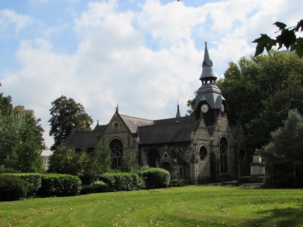
Landmark buildings include the old Poplar Town Hall, now a hotel, the Grade II*-listed St Matthias Old Church (originally the chapel built by the East India Company in 1654 and now a community centre), the Grade II-listed All Saints Church, dating from 1821-23, and the Museum of London Docklands at West India Quay.
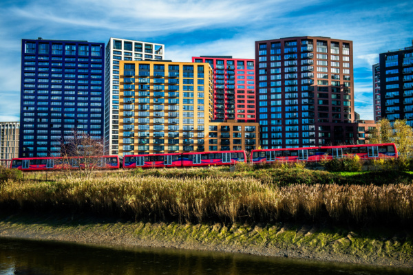
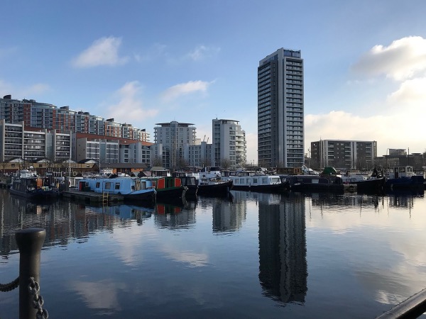
The area also features considerable post-war housing including the Brutalist-style 26 storey Balfron Tower. In more recent years, with the development of the Docklands and the linking of the area to the city by the Docklands Light Railway, the area has continued to undergo regeneration.

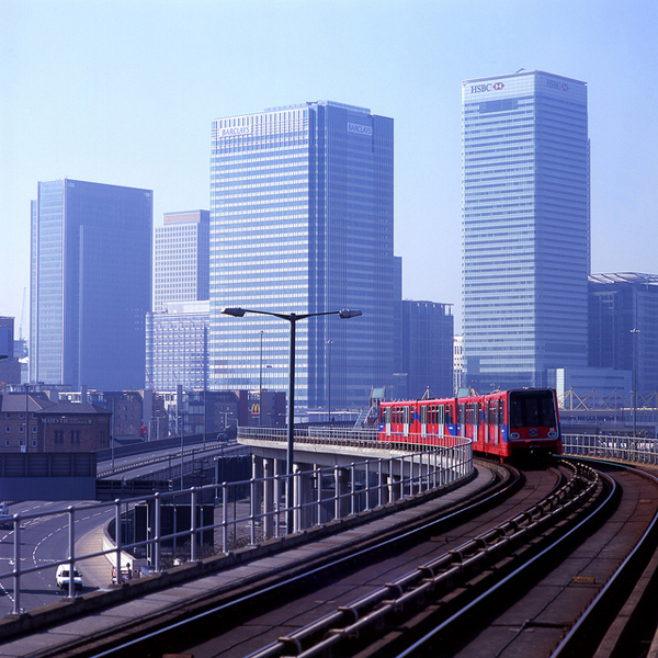
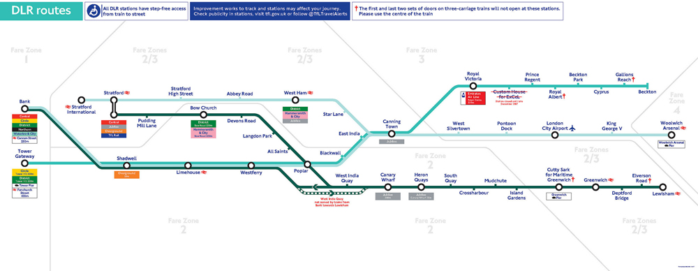
The DLR, or Docklands Light Rail, is a driverless train network connected to the Tube system.
The DLR, which is located at the eastern end of the city, connects to the Tube network at numerous stations including Bank, Tower Gateway and Canary Wharf. It reaches as far south as Lewisham, east to Beckton and Woolwich Arsenal and north to Stratford International.
The 24 mile-long network, which first opened on 31st August 1987 and has since been extended numerous times, has 45 stations. It also provides connections to the Emirates Air Line and London City Airport.
The DLR trains run from around 5.30am to around 12.30am from Monday to Saturday with Sunday services starting later and finishing earlier.
The fares are the same as the Tube and you can use Oyster cards.
In the 2019/2020, the line hosted more than 115 million passenger journeys.
For a route map, head to https://content.tfl.gov.uk/dlr-route-map.pdf
London’s Docklands Light Railway – the DLR as it’s better known – is celebrating 30 years of operation. The railway was officially opened by Queen Elizabeth II in the summer of 1987 and then had just 11 single carriage trains serving 15 stations. Extended six times since and now including some 38 kilometres of track, it now serves 45 stations using mainly three carriage trains. Carrying some 6.7 million passengers in its first year, it now carries a massive 122 million people annually. To mark the occasion, Transport for London has released a Destination DLR travel guide featuring 30 attractions across east and south-east London all easily reached by the DLR, ranging from the National Maritime Museum at Greenwich and the Tower of London to Queen Elizabeth Olympic Park and Wilton’s Music Hall. Transport for London have also released a new diagram of the DLR system (pictured below). PICTURES: Transport for London.

Sailing high over the River Thames between North Greenwich in the river’s southern bank and the Royal Docks on the river’s northern bank is the cable car formally known as the Emirates Air Line. Opened in late June and running every day, the cable car – the UK’s first in an urban area – is operated by Transport for London and links into the Underground and Docklands Light Rail network. Travelling at about 90 metres above the ground along a course of more than half a mile, passengers can take in the City, Docklands, Greenwich and as far eastward down the river as the Thames Barrier. This image, which shows the 02 Arena in the background, was taken just after the Closing Ceremony of the Olympic Games in August. For more, see www.emiratesairline.co.uk. PICTURE: © Transport for London
