This City of London street is named for a church which once stood to the east of the thoroughfare.
The church was founded as part of a monastery the 11th century by brothers Ingelric and Girard – the former was apparently a man of some influence in the courts of King Edward the Confessor and King William the Conqueror (although there is apparently a tradition that the church was founded earlier, by the Saxon King Wihtred of Kent, in the 7th or 8th century).
The collegiate church, which had the job of sounding the curfew bell in the evenings to announce the closing of the city gates during the reign of King Edward I (the right later moved to another church), gave special rights to the precinct in which it stood including that of sanctuary for certain types of criminals. Indeed, by the 14th century, it was the largest area of sanctuary in England.
This was particularly useful for those making what was supposed to be their final journey from Newgate to their execution at Tower Hill – the precinct lay along the route and, yes, some were said to have escaped into the district as they passed by. But perhaps the most famous said to have sought sanctuary in the precinct were Miles Forrest, one of those accused of murdering the so called “Princes in the Tower” – King Edward V and his brother Richard, Duke of York.
The institution was dissolved during the reign of King Henry VIII and demolished in the mid-16th century but the name lived on in the precinct where it once stood – during the Elizabethan era it was apparently famous for its lace.
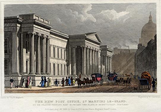
The site of the church was later the site of the General Post Office, built in 1829, which was eventually demolished in 1911 and replaced by a premises located to the west.
The street, which becomes Aldersgate Street in the north and runs into Cheapside in the south, was also once home to the The Bull and Mouth Inn, destroyed in the Great Fire of 1666, and a French Protestant Church. The latter was built in 1842 but demolished in 1888 to make way for more Post Office buildings.
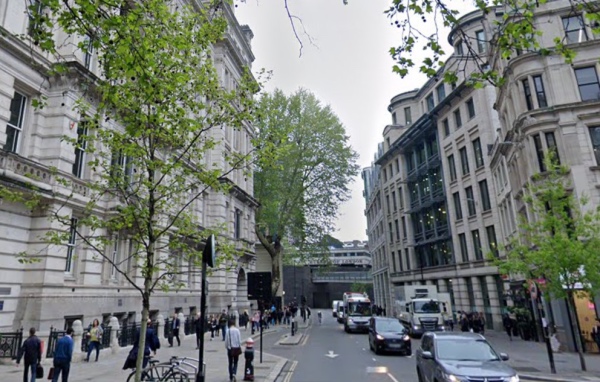
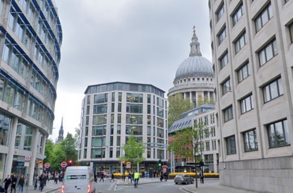
PICTURES: Looking south (top) and north (below) from St Martin-le-Grand (Google Maps).