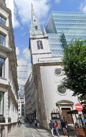
Looking northward up Rood Lane with St Margaret Pattens to the right. PICTURE: Google Maps.
This name of this short City of London laneway which runs between Eastcheap and Fenchurch Street in the City of London has nothing to do with rudeness or lewdness (as you have no doubt guessed).
Rather it’s an ancient term for a crucifix, known in days past as a ‘rood’ or ‘rood cross’.
The laneway was originally known as St Margaret Pattens Lane, a church which, dating back as far as the 12th century, still stands on the corner of the laneway and Eastcheap.
It’s a crucifix which once stood in the churchyard gave the laneway its new name.
Historian John Stow wrote that on 23rd May, 1538, the crucifix was found smashed into pieces “by people unknown”.
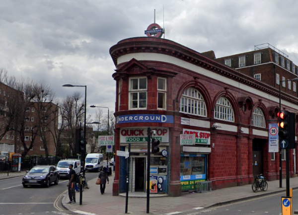
Known to many as the eastern end of the District Line, Upminster is located some 16.5 miles to the north-east of Charing Cross and is part of the London Borough of Havering.
Historically a rural village in the county of Essex, its name comes from Old English and means a large church or “minster” located on high ground.
The church is said to have dated at least as far back as the 7th century and to have been one of a number founded by St Cedd, a missionary monk of Lindisfarne, in the area. It was located on the site occupied by the current church of St Laurence (parts of which date back to the 1200).
The nearby bridge over the River Ingrebourne shares the name Upminister and is known to have been in existence since the early 14th century.
Once wooded, the area was taken over for farming (cultivation dates as far back as Roman times) and by the 19th century it came to be known for market gardens as well as for some industry including windmills and a brickworks.
Development was initially centred around the minister and nearby villages of Hacton and Corbets Tey. It received a boost in the 17th century when wealthy London merchants purchased estates in the area.
Improved transportation links also helped in later centuries including the arrival of the London, Tilbury and Southend Railway in 1885 – it was extended from Barking – and the underground in 1902 via the Whitechapel and Bow Railway.
Landmarks include the Church of St Laurence, the redbrick Clock House (dating from about 1775), the 16th century house Great Tomkyns, the Grade II*-listed Upminster Windmill, built in 1803 and considered one of England’s best surviving smock mills, and the 15th century tithe barn (once owned by the monks of Waltham Abbey and now a museum).
Upminster Hall, which dates back to the 15th and 16th century (and, once the hunting seat of the abbots of Waltham Abbey, was gifted by King Henry VIII to Thomas Cromwell after the Dissolution), is now the clubhouse of the Upminister Golf Club.
Hornchurch Stadium, the home ground of AFC Hornchurch, is located in the west of the area.
It was in Upminster that local rector Rev William Derham first accurately calculated the speed of sound, employing a telescope from the tower of the Church of St Laurence to observe the flash of a distant shotgun as it was fired and then measuring the time before he heard the gunshot using a half second pendulum.
This City of London street runs north-south from the junction of Newgate Street, Holborn Viaduct and Old Bailey to West Smithfield. Its name comes from those who once travelled along it.
Looking south down Giltspur Street, with the dome of the Old Bailey visible, in 2018. PICTURE: Courtesy of Google Maps
An alternative name for the street during earlier ages was Knightrider Street which kind of gives the game away – yes, the name comes from the armoured knights who would ride along the street in their way to compete in tournaments held at Smithfield. It’s suggested that gilt spurs may have later been made here to capitalise on the passing trade.
The street is said to have been the location where King Richard II met with the leaders of the Peasant’s Revolt who had camped at Smithfield. And where, when the meeting deteriorated, the then-Lord Mayor of London William Walworth, ending up stabbing the peasant leader Wat Tyler who he later captured and had beheaded.
St Bartholomew’s Hospital can be found on the east side of the street. On the west side, at the junction with Cock Lane is located Pye Corner with its famous statue of a golden boy (said to be the place where the Great Fire of London was finally stopped).
There’s also a former watch house on the west side which features a monument to the essayist late 18th century and 19th century Charles Lamb – the monument says he attended a Bluecoat school here for seven years. The church of St Sepulchre-without-Newgate stands at the southern end with the Viaduct Tavern on the opposite side of the road.
The street did formerly give its name to the small prison known as the Giltspur Street Compter which stood here from 1791 to 1853. A prison for debtors, it stood at the street’s south end (the location is now marked with a City of London blue plaque).
This north London thoroughfare, which runs north-east from Southampton Row through Holborn to Gray’s Inn Road is named for the destination it once led to – a country house in Hertfordshire known as Theobolds which once belonged to King James I.
View down Theobolds Road at its northern end. PICTURE: Courtesy of Google Maps
The house, which has been rebuilt many times and is now a conference centre, was actually where King James I died. Prior to his residency, it was home to Queen Elizabeth I’s advisor, William Cecil, Lord Burghley, and then his son, Robert Cecil, the first Earl of Salisbury.
The road, which the modern Theobolds Road forms part of, was apparently also known as the King’s Way due to its royal traveller – this royal connection is still retained in the nearby roadway known as Kingsway.
Among the famous residents of Theobolds Road was Prime Minister Benjamin Disraeli who was born at number 22 in 1804 (and is now commemorated with an English Heritage Blue Plaque, although this one is actually brown).
This north London district owes its name to the family estate on which it was developed.
The district, one of the first planned residential developments in London, was developed in the early 1770s along what was known as New Road. It can be found to the north of Clerkenwell with King’s Cross to the west and Angel to the east.
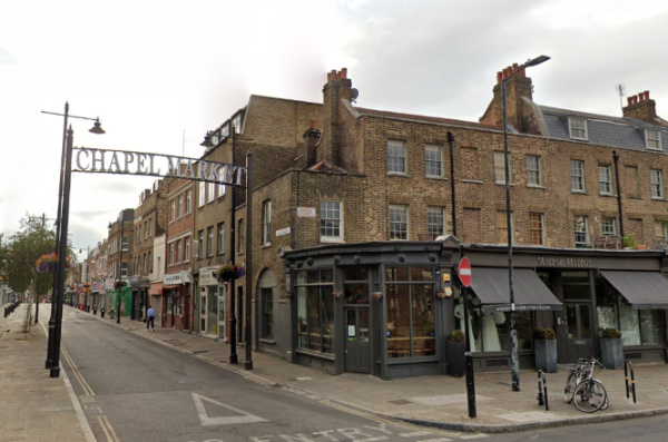
Corner of Chapel Market and Penton Street, Pentonville. PICTURE: Courtesy of Google Maps
Set within rolling fields, it was named for the family who owned the land which it was developed – that of Henry Penton, a Lord of the Admiralty, whose family, who hailed from Winchester, had owned the land for a couple of generations. The suffix “ville” was added to give the land sales appeal (a move which proved less popular after the rise of Napoleon thanks to its associated with French).
The new suburb was laid out mostly in a grid pattern on Islington Hill with the first street, named Penton Street, was completed in 1773. Building of further streets continued sporadically over the ensuing decades until the 1840s.
A church – St James Pentonville – was built halfway up the hill on Pentonville Road; it survived until its demolition in 1984. The burial grounds now form a public park – the Joseph Grimaldi Park (named for the clown who is buried within it). Other notable burials include Henry Penton.
Chapel Market was built as a residential street in 1790 but gradually transformed into a market and shops (it still contains some original properties).
Other landmarks include St Silas Church, Pentonville, which opened in 1863 and still stands in Risinghill Street, and the Church of St Mark the Evangelist, which opened in Myddleton Square in 1855, and was demolished in 1970.
Initially a fashionable place to live, this led to the term ‘Pentonville’ being used to describe an area beyond its original boundaries (Charles Dickens was apparently guilty of doing this). But its reputation began to fade during the mid-19th century as some homes were converted into businesses and others became boarding houses and tenements. By the turn of the century it was one of London’s poorest districts.
The area was partly redeveloped with council housing during the period between the two world wars – this was continued to a greater degree after World War II.
Incorporated into the London Borough of Finsbury in 1899, Pentonville became part of the London Borough of Islington in 1965 (there was Pentonville ward in the borough until 1978).
Famous residents have included philospher and economist John Stuart Mill (born at 13 Rodney Street in 1806) and Vladimir Lenin, who lived with his wife at 30 Holford Square just off Pentonville Road briefly in 1902-03.
Pentonville Road, formerly part of New Road, shares the name and a number of other streets also feature related names including, of course, the aforementioned Penton Street. Interestingly, the (in)famous HM Prison Pentonville, is not located in the area but in Caledonian Road in Barnsbury, some distance to the north.
Of course, Pentonville (in the form of Pentonville Road) can also be found in the pale blue section of properties on the Monopoly board.
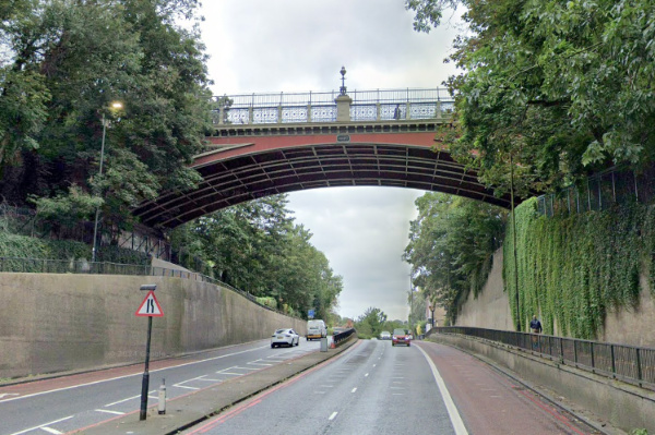
This north London district in the London Borough of Islington owes its name to a bridge which straddles Archway Road (part of the Great North Road or A1).
The bridge’s origins go back to the early 19th century when work began on a 230 metre-long tunnel underneath Highgate Hill which would allow users to bypass the hill’s steep gradient. If completed, it’s said it would have been the earliest road tunnel in Britain.
But in April, 1812, the tunnel collapsed and a cutting through the hill, utilising the work done on the collapsed tunnel, was then proposed. It would become Archway Road.
Hornsey Lane, however, ran across the top of the hill linking Highgate to its west to Crouch End in the east, and to ensure the lane remained when the cutting was completed, it was decided to build a viaduct to carry the lane across the cutting.
The bridge over Archway Road (the A1) as it is today. PICTURE: Google Maps
The resultant structure was designed by none other than John Nash in the style of a Roman aqueduct and opened in 1813.
Archway Road, which ran underneath the arch, was operated as a toll road until 1871.
The bridge, meanwhile, was demolished in 1900 and replaced by a cast iron bridge, designed by Alexander Binnie, which still stands.
The area was referred to as Highgate Archway but gradually the Highgate was dropped and plain Archway adopted.
This was reinforced by the naming of the Tube station in Junction Road which was originally named Highgate when it opened in 1907 as the terminus of the Northern Line but was renamed Archway (Highgate) in 1939 and then just Archway in 1947.
Landmarks in this predominantly leafy residential area include the Whittington Hospital, originally built as the Holborn Union Infirmary 1877-79, on Highgate Hill.
On a similar theme, the Whittington Stone can also be found at the bottom end of Highgate Hill. It is said to commemorate the spot where Dick Whittington, having decided to leave London after failing to make his fortune, heard the Bow Bells ringing and turned back (the stone is topped with a statue of Whittington’s famous cat).
The green expanse of Hampstead Heath lies just to the west.
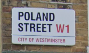
This Soho thoroughfare, which runs from Broadwick Street north to Oxford Street, isn’t directly named after Poland.
PICTURE: Courtesy of Google Maps
Instead its name comes from a tavern which once stood at the Oxford end of the street – the King of Poland, said to have been named in honour of King John III Sobieski who led a coalition of forces which defeated the Ottoman Empire at the Battle of Vienna in 1683.
Polish Protestants settled around the area in the 18th century, fleeing the Polish Counter-Reformation.
Famous residents have included Romantic poet Percy Bysshe Shelley (number 15; it’s marked with an English Heritage Blue Plaque) and William Blake (number 28).
The pub, incidentally, is said to have changed its name a couple of times – most latterly to the Dickens Wine House – before it was destroyed by a bomb in 1940.
Another pub in the street – the Kings Arms – stands on the site of an earlier tavern where the “Ancient Order of Druids” was revived in 1781.
The Poland Street Garage, meanwhile, opened here in 1934 and is said to have been the first multi-storey car park in London.
This district of London, which lies to the south-east of Peckham in the London Borough of Southwark, is believed to owe its name to a local tavern named, you guessed it, the Nun’s Head on the linear Nunhead Green (there’s still a pub there, called The Old Nun’s Head, in a building dating from 1905).
The Old Nun’s Head near Nunhead Green. PICTURE: Google Maps
There may well have been actual nuns here (from which the tavern took its name) – it’s suggested that there was a nunnery here which may have been connected to the Augustinian Priory of St John the Baptist founded in the 12th century at Holywell (in what is now Shoreditch).
A local legend gets more specific. It says that when the nunnery was dissolved during the Dissolution, the Mother Superior was executed for her opposition to King Henry VIII’s policies and her head was placed in a spike on the site near the green where the inn was built.
While the use of the name for the area goes back to at least the 16th century, the area remained something of a rural idyll until the 1840s when the Nunhead Cemetery, one of the “Magnificent Seven” cemeteries of Victorian London, was laid out and the area began to urbanise.
A fireworks manufactory – Brocks Fireworks – was built here in 1868 (evidenced by the current pub, The Pyrotechnists Arms). The railway arrived in 1871.
St Antholin’s Church was built in 1877 using funds from the sale of the City of London church, St Antholin’s, Budge Row, which was demolished in 1875. St Antholin’s in Nunhead was destroyed during the Blitz and later rebuilt and renamed St Antony’s (the building is now a Pentecostal church while the Anglican parish has been united with that of St Silas).
There’s also a Dickens connection – he rented a property known as Windsor Lodge for his long-term mistress, actress Ellen Ternan, at 31 Lindon Grove and frequently visited her there (in fact, it has even been claimed that he died at the property and his body was subsequently moved to his home at Gad’s Hill to avoid a scandal).
Nunhead became part of the Metropolitan Borough of Camberwell in 1900. These days, it’s described by Foxtons real estate agency as “a quiet suburb with pretty roads and period appeal”.
View of Castletown Road in Barons Court. PICTURE: Courtesy of Google Maps
This district in west London doesn’t have anything to do with any particular baron but rather was named Barons Court by the late 19th century developer Sir William Palliser.
It apparently refers to the Court Baron, a form of manorial court which could be held in medieval times by any Lord of the Manor and is perhaps a nod to nearby Earl’s Court. It’s said by some that it may also be a reference to the Baronscourt estate in County Tyrone, Northern Ireland, where Sir William possibly had connections.
Many of the street names refer to members of the Palliser family or estates and the district, which lies between West Kensington and Hammersmith, features a Tube station which opened in 1905.
Barons Court did suffer bomb damage during World War II.
Landmarks include the London Academy of Music and Dramatic Art (LAMDA), housed in what was formerly a ballet school on Talgarth Road, the Queen’s Club tennis club, and the Margravine or Hammersmith Cemetery, which, laid out by architect George Saunders, opened in 1868.
Looking north up Basinghall Street from Gresham Street. The buildings on the left are part of the Guildhall complex. PICTURE: Google Maps
This City of London street, which sits on the eastern side of the Guildhall complex, is named for the wealthy Basing (or Bassing) family who had a hall here in the 13th century.
The street, which links Gresham Street in the south to Basinghall Avenue in the north, has been the site of numerous prominent buildings including the medieval hall of the Weaver’s Company (demolished in 1856, having replaced an earlier hall which burnt down in the Great Fire of London in 1666, the hall is now located in Gutter Lane), the Cooper’s Company (demolished in 1867, the hall is now located in Devonshire Square) and the Girdler’s Company (destroyed in the Blitz in 1940; the hall is now located in Basinghall Avenue).
It was also the location of the Sir Christopher Wren-designed Church of St Michael Bassishaw until 1899 after it was seriously damaged when the crypt was being cleared of human remains in line with the orders of City authorities. The parish with united with St Lawrence Jewry.
Famous denizens included the goldsmith, banker and civil engineer Sir Hugh Myddelton, most renowned for his design of the New River scheme to bring clean water to the City, who, according to The London Encyclopaedia, would sit in the doorway of his office and smoke his pipe while chatting with the likes of Sir Walter Raleigh.
The family also gave their name to the City of London’s Bassishaw Ward.
And so we come to our annual countdown of our most read new posts for 2023 (although the data is indicative only of posts looked at on their own page (and not on the homepage). But, with that caveat, we commence the countdown…
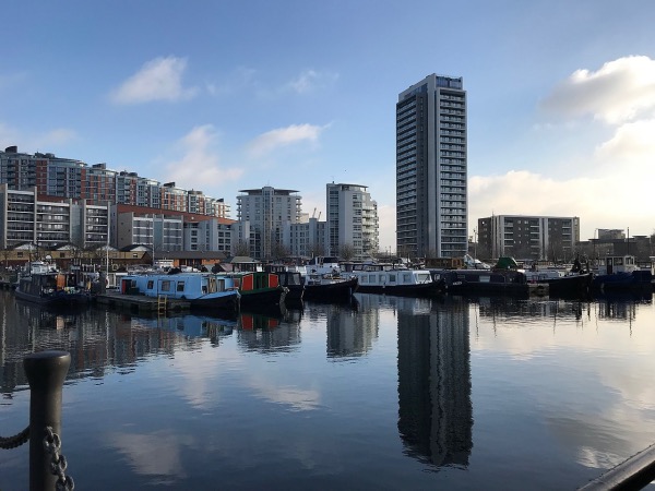
Poplar Dock and Horizons Tower in East London. PICTURE: Matt Brown (licensed under CC BY 2.0)
Though they no longer in evidence, this Thames-side East London district takes its name from the Black Poplar trees which were once abundant in the area.
The area was apparently fertile ground for the poplars thanks to the proximity of the Lea and Thames Rivers which created the moist soil the tree needs. There was still a poplar tree in the area until the mid-1980s.
The name goes back to the 14th century but Poplar wasn’t an independent parish until the 19th century (before which it was a hamlet of Stepney). Poplar is now part of the Borough of Tower Hamlets.
The medieval village of Poplar was centred on Poplar High Street and the East India Company, which built ships in Blackwall Yard, established a chapel and almshouses in Poplar.
The area expanded rapidly in the early 19th century thanks to the maritime industries that grew up here but by late that century this had diversified into other manufacturing and transport-related industries.
The area has long had a maritime association with ship fitting taking place in the area from the 15th century. Poplar was impacted by bombings during World War I and then devastated during the Blitz with about half the houses in the area damaged and the population dropping significantly as a result.
St Matthias Old Church, now a community centre, in Poplar. PICTURE: Michael Day (licensed under CC BY-NC 2.0)
Landmark buildings include the old Poplar Town Hall, now a hotel, the Grade II*-listed St Matthias Old Church (originally the chapel built by the East India Company in 1654 and now a community centre), the Grade II-listed All Saints Church, dating from 1821-23, and the Museum of London Docklands at West India Quay.
The area also features considerable post-war housing including the Brutalist-style 26 storey Balfron Tower. In more recent years, with the development of the Docklands and the linking of the area to the city by the Docklands Light Railway, the area has continued to undergo regeneration.
Looking northward up Pudding Lane (to the right of the picture is a somewhat controversial plaque marking the site of the bakery). PICTURE: Google Maps
While it has been claimed in the past that the name did come from desserts or puddings being sold here, it’s now generally believed that the name relates to the medieval word ‘pudding’ which meant offal – the guts or entrails of animals.
It was apparently down this lane that the butchers of the Eastcheap market (London’s primary meat market in medieval times, located at the northern end of the lane), having slaughtered an animal for consumption, would have the ‘puddings’ carried down the lane so they could be disposed of on waste barges (earlier on, the butchers were apparently permitted to toss the offal into the Thames when tide conditions were right).
The lane, which 16th century historian John Stow said was also known as Rother Lane (due to a Thames wharf called Rothersgate at its southern end) and Red Rose Lane (after a shop sign in the lane), also has the honour of being one of the world’s first designated one-way streets.
This area in London’s north was recorded as far back as the 13th century when it was known Chaldecote, meaning “cold cottages”.
It’s been suggested that the name may have referred to accommodation for travellers who were travelling up to Hampstead.
Chalk Farm Underground Station in the heart of the area. PICTURE: Courtesy of Google Maps
The area was part of the prebendal manor of Rugmere and was gifted to Eton College by King Henry VIII in the 15th century.
The area was still farmland by the 17th century and what was then known as Upper Chalcot Farm was located at the end of what’s now England’s Lane. At Lower Chalcot was an inn known as the White House (apparently for its white-washed walls) – believed to have been built on the site of the original manor house.
By the 18th century, the farm was known as Chalk House Farm (apparently a corruption of Chalcot). The Chalk Farm Tavern was built on the site in the 1850s and was a popular entertainment venue which featured tea gardens (and in more recent times was a restaurant).
The area, which had been a popular site for duelling, underwent development from the 1820s – some of the street names, such as Eton Villas and Provost Road reflect the area’s relationship with Eton College.
This development received a considerable boost in the early 1850s when the London to Birmingham railway had its London terminus in Chalk Farm (it’s now Primrose Hill Station). The former railway building known as the Roundhouse is a legacy of the railway’s arrival.
Chalk Farm became part of the London Borough of Camden in the 1960s.
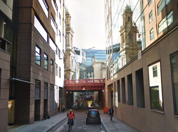
The view looking north from the southern end of Carmelite Street. PICTURE: Google Maps
These two City of London thoroughfares – which run from Fleet Street down to Victoria Embankment (connected at Tudor Street) – both owe their name to the same institution.
A friary run by the Carmelites – also known as the “White Friars” because of the white mantle they wore over their brown habits – was established here in 1253 and enlarged until eventually it stretched all the way from Fleet Street down to the Thames.
The monastery was dissolved in the Dissolution and the buildings repurposed with the great hall becoming a playhouse.
The street marks the eastern boundary of the friary (then known as Water Lane).
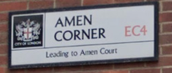
Located off Ave Maria Lane in the City of London is a tiny thoroughfare named Amen Corner.
This location of this short laneway – which leads to the U-shaped (and gated) Amen Court – makes the name no great surprise. It lies just to the north-west of St Paul’s Cathedral and is one of a number of religiously named streets in the area (others include Paternoster Lane, Paternoster Square, Paternoster Row and Canon Alley).
The corner apparently became so-named in relation to a prayer chanted by monks. It’s said that on the day of the Feast of Corpus Christi, the monks would process through the streets, chanting prayers as they did so.
The first prayer, the Lord’s Prayer, was started in Paternoster Row – itself named after the first couple of words in the prayer when recited in Latin (“Pater Noster” which translates as “Our Father”). The monks would then process westward and by the time they reached the corner of Paternoster Lane and Ave Maria Lane, they would be at the end of the prayer – “Amen”. Hence Amen Corner.
Amen Corner was, from 1614 until the Great Fire of London in 1666 when it was destroyed, the location of a three storey house which served as the headquarters of the the Royal College of Physicians.
Ave Maria Lane, meanwhile, is named after the next prayer the monks would recite after turning the corner – “Ave Maria” (Hail Mary”).
Amen Court, which isn’t accessible to the public, is home to a short terrace of 17th-century houses where the cathedral’s canons have traditionally lived.
At its western end is a wall which once marked the boundary of Newgate Prison and which itself has an interesting history. The spectral ‘Black Dog of Newgate’ was said to have been sighted crawling along its top just prior to an execution taking place in the prison.
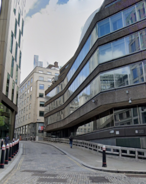
Looking south down Shoe Lane from near Charterhouse Street where it passes under the Holborn Viaduct. PICTURE: Courtesy of Google Maps.
This name of this rather long laneway, which runs from Charterhouse Street, under Holborn Viaduct, all the way south to Fleet Street, doesn’t have anything to do with footwear.
The name is actually a corruption of the Sho Well which once stood at the north end of the thoroughfare (and which itself may have been named after a tract of land known as Shoeland Farm thanks to it resembling a shoe in shape).
In the 13th century the lane was the London home of the Dominican Black Friars – after they left in the late 13th century, the property became the London home of the Earl of Lincoln and later became known as Holborn Manor.
In the 17th century, the lane was known as for its signwriters and broadsheet creators as well as for a famous cockpit which was visited by none other than diarist Samuel Pepys in 1663. It was also the location of a workhouse.
Prominent buildings which have survived also include St Andrew Holborn, designed by Sir Christopher Wren (it actually survived the Great Fire of London but was in such a bad state of repair that it was rebuilt anyway). The street these days is lined with office buildings.
Famous residents have included John de Critz, Serjeant Painter to King James I and King Charles I, preacher Praise-God Barebone who gave his name to Barebone’s Parliament held in 1653 during the English Commonwealth, and Paul Lovell, who, so the story goes, refused to leave his house during the Great Fire of 1666 and so died in his residence.
The Angel Hotel, built in 1903. PICTURE: Des Blenkinsopp (licensed under CC BY-SA 2.0)
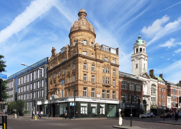
Located just north of Clerkenwell, this inner city district is centred on the intersection of Islington High Street and Pentonville Road.
Its name come from a building that once stood on that site – the Angel Inn, which was existent in the early 17th century. The building has since gone through several incarnations with the current structure on the site, the Angel Hotel, built in 1903, and now used as offices. A modern pub, called the Angel, is adjacent.
The district encompasses both the triangular Islington Green in the north and Chapel Market in the west.
Angel is also the name of a Tube station on the Northern Line. Other landmarks include the Angel Wings sculpture in Liverpool Road.
The Angel Islington is also, of course, a property on the Monopoly board (one of the cheapest in reflection of the area’s standing at the time of the game’s creation, before the gentrification that took place there in the 1980s).
The story goes that it was in 1936 that Victor Watson, founder of the game’s manufacturers John Waddington Ltd, who decided to include the property whilst taking tea at the cafe when occupied the lower floors of the Angel Hotel.
The medieval church, which was rebuilt after being destroyed in the Great Fire of London only be badly damaged in the Blitz and finally demolished in 1962, was located on the corner of the laneway’s intersection with Cannon Street.
The church was the resting place of Catrin Glyndŵr, wife of the rebel Edmund Mortimer and daughter of Welsh leader Owain Glyndŵr, who, after being held in the Tower of London, died in mysterious circumstances (there’s a memorial to her in a garden on the former site of the church).