Where’s London’s oldest…football stadium?

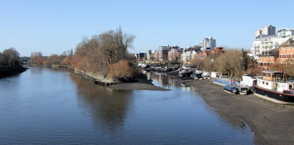
Craven Cottage, home of Fulham FC on the bank of the River Thames in west London, is the city’s oldest football stadium.

Craven Cottage (with the Grade II-listed Johnny Haynes Stand on the left in 2021. PICTURE: Nick/Flickr (licensed under CC BY-NC-SA 2.0)/Image cropped

The site has been home to the club since 1896, having previously been based at a range of grounds. It took two years to prepare the ground for play including constructing a changing room building.

The first match was played at the ground on 10th October, 1896 (Fulham beat Minerva 4-0 in the Middlesex Senior Cup).

Initially the ground was surrounded with terracing only – this changed in 1903 when the first stand was built on the north side of the ground. Providing seating for 1,200 spectators, it was affectionately known as the ‘Rabbit Hutch’.

The stand didn’t last long. Just 18 months later, it was condemned as dangerous by municipal officials and had to be pulled down.

In January, 1905, it was reported that the club had gained a 99-year lease on the ground. Work on a new stand, 5,000-seat, started just four months later to be designed by Archibald Leitch with steelwork provided by Clyde Structural Iron Company. Known as the Stevenage Road Stand (with a brick facade on the road), it opened on 2nd September that year.

The Cottage Pavilion in 2018. PICTURE: Nick/Flickr (licensed under CC BY-NC-ND 2.0)/Image cropped

Leitch also designed the Cottage Pavillion, located at the south-east corner of the ground, which was used for change rooms and by the club’s administration.

In 1907, the club hosted the first full international match when, in March, 1907, England and Wales drew 1-1.

While the club regularly saw crowds of up to 40,000 in the lead-up to World War II, a record was set in 1938 at a game between Fulham and Millwall when the crowd numbered just shy of 50,000.

These days there are four stands: the Grade II-listed Johnny Haynes Stand on the east side of the ground (it was renamed in 2005 in honour of the club legend who also has a statue at the ground); the Riverside Stand on the west side (redeveloped in recent years); the Hammersmith End stand (located to the north of the ground, traditionally its home end); and, the Putney End stand (located at the south end).

The Cottage Pavilion, the balcony of which is from where player’s families have traditionally watched games, remains in the south-east corner.

10 most popular (new) posts for 2023 – Numbers 10 and 9…

And so we come to our annual countdown of our most read new posts for 2023 (although the data is indicative only of posts looked at on their own page (and not on the homepage). But, with that caveat, we commence the countdown…

10. 10 historic vessels in London’s Thames…1. PS Tattershall Castle…

9. What’s in a name?…Chalk Farm…

What’s in a name?…Poplar…

Poplar Dock and Horizons Tower in East London. PICTURE: Matt Brown (licensed under CC BY 2.0)

Though they no longer in evidence, this Thames-side East London district takes its name from the Black Poplar trees which were once abundant in the area.

The area was apparently fertile ground for the poplars thanks to the proximity of the Lea and Thames Rivers which created the moist soil the tree needs. There was still a poplar tree in the area until the mid-1980s.

The name goes back to the 14th century but Poplar wasn’t an independent parish until the 19th century (before which it was a hamlet of Stepney). Poplar is now part of the Borough of Tower Hamlets.

The medieval village of Poplar was centred on Poplar High Street and the East India Company, which built ships in Blackwall Yard, established a chapel and almshouses in Poplar.

The area expanded rapidly in the early 19th century thanks to the maritime industries that grew up here but by late that century this had diversified into other manufacturing and transport-related industries.

The area has long had a maritime association with ship fitting taking place in the area from the 15th century. Poplar was impacted by bombings during World War I and then devastated during the Blitz with about half the houses in the area damaged and the population dropping significantly as a result.

St Matthias Old Church, now a community centre, in Poplar. PICTURE: Michael Day (licensed under CC BY-NC 2.0)

Landmark buildings include the old Poplar Town Hall, now a hotel, the Grade II*-listed St Matthias Old Church (originally the chapel built by the East India Company in 1654 and now a community centre), the Grade II-listed All Saints Church, dating from 1821-23, and the Museum of London Docklands at West India Quay.

The area also features considerable post-war housing including the Brutalist-style 26 storey Balfron Tower. In more recent years, with the development of the Docklands and the linking of the area to the city by the Docklands Light Railway, the area has continued to undergo regeneration.

London Explained – Parish boundary markers…

You may have noticed small stone or metal plaques installed on buildings which are inscribed with some letters and a date.

These are typically parish boundary markers, marking the geographical reach of a particular parish. The letters refer to the parish name and the date when the boundary was set or marked (some markers actually have more than one date, the second being when parish boundaries were confirmed).

Parish boundary markers in Chancery Lane. PICTURE: R~P~M (licensed under CC BY-NC-ND 2.0)

Traditionally, parishioners were reminded of the boundaries each year at Rogationtide – the three days of the Monday, Tuesday and Wednesday before Ascension Day (39 days after Easter Sunday) – in a ceremony known as the ‘Beating the Bounds’.

This custom involved the priest and parishioners, led by the churchwardens and beadle, walking around the stones which served as boundary markers and pausing to beat each one with sticks and pray for protection and blessings (apparently there was also a practice of pushing boys from the charity schools into the boundary walls so they’d remember them or beating them with willow wands when there was no wall).

The boundary stones have, in more recent centuries, been replaced by the plaques in London but the ceremony is still carried out in some parishes.

Interestingly, in some parishes, the boundary is located in the midst of the Thames and boats are taken to ‘beat the mark’ in the middle of the river.

10 historic vessels in London’s Thames…8. MV Havengore….

The MV Havengore. PICTURE: Robin Webster (licensed under CC BY-SA 2.0)

Still plying the waters of the Thames, the MV Havengore is perhaps most famous for having carried the coffin of Sir Winston Churchill on the River Thames as part of his state funeral in 1965.

The MV Havengore – named for a low-lying island off the coast of Essex – was originally constructed as a hydrographic survey launch for the Port of London Authority in 1956. As the PLA’s principal survey vessel and flagship, she was moored at Gravesend and tasked with recording changes to Thames bed and estuary. She became the first survey vessel in the UK to have a computer to record survey data.

The highpoint of her during her almost 40 years of service with the PLA came on 30th January, 1965, when she transported the body of Churchill from Tower Pier to Festival Pier. On the journey, she was saluted by flight of 16 fighter jets while dock cranes were made to bow as she passed (there’s a plaque on board commemorating her role in the funeral).

But the almost 26 metre long vessel also participated in other historic events including the river pageant to celebrate the Queen Elizabeth II’s Silver Jubilee in 1977 and, more recently, the flotilla formed to celebrate the Queen’s Diamond Jubilee in 2012 as well as the Thames tribute to the Queen’s long reign in 2015 and the Queen’s 90th birthday parade in 2016.

The MV Havengore was withdrawn from service in 1995 and sold after which she underwent restoration and refitting at the Chatham Historic Dockyard. The vessel was then used to provide excursions for underprivileged children on the Medway.

Sold again in 2006, she has subsequently undergone further restoration work. The MV Havengore is these days used for a range of ceremonial, corporate and private events. When not on the river, she is berthed at St Katharine Docks. The vessel was listed, as of May this year, as being up for sale.

10 historic vessels in London’s Thames…4. ‘Massey Shaw’…

The Massey Shaw in The Thames in 2015. PICTURE: R~P~M (licensed under CC BY-NC-ND 2.0)

Moored at West India Dock, the Massey Shaw is a former London Fire Brigade fireboat.

The fireboat was constructed in 1935 for a cost of £18,000 by the J Samuel White company in Cowes on the Isle of Wight. Named for Sir Eyre Massey Shaw – the first Chief Officer of what was then named the Metropolitan Fire Brigade, the vessel was designed to London County Council specifications with a deliberately low profile so it could fit under the Thames bridges in all tides.

The vessel, which was was powered by two eight cylinder diesel engines and featured a main deck monitor as well as eight deck outlets (and a wheelhouse which was added later), soon proved its worth, playing an important role in saving what the press said was a million pounds worth of stock at a large warehouse fire on Colonial Wharf.

During World War II, the Massey Shaw took part in Operation Dynamo, forming part of the small boat flotilla which evacuated British troops from the beach at Dunkirk. She ferried more than 500 troops to a larger ship offshore and transported almost 100 back to England and it’s believed she was the last of the small boats to leave Dunkirk harbour (rescuing survivors from a French vessel which struck a mine along the way).

Back in London, Massey Shaw performed a critical role during the Blitz, pumping large quantities of Thames water to douse fires along the city’s waterfront.

It remained in service until the early 1970s, although it had operated as a reserve boat since 1960 with newer models taking over frontline duties.

Decommissioned in 1971, the Massey Shaw was found abandoned 10 years later at St Katharine Dock by a group who went on to found The Massey Shaw Fireboat Society with a view to preserving the vessel. They were granted a 50 year lease on the vessel.

In 1985, the Massey Shaw joined the Association of Dunkirk Little Ships on their return to Dunkirk for the first time since 1965 and two years later, she attended the centenary of Sir Eyre Massey Shaw’s review of 1000 firemen at Oxford.

In 1990 the Massey Shaw was sunk close to the London Fire Brigade headquarters at Lambeth but was subsequently salvaged and the following year, after restoration work, joined the 50th anniversary return trip to Dunkirk.

The society gained full ownership of Massey Shaw in 2002 and restoration work was carried out by the TV programme Salvage Squad (a second appearance on the show and more work followed two years later).

In 2008, a £500,000 Heritage Lottery Grant was used to fund the restoration of the vessel at Gloucester docks. She returned to London by road in 2013 where the restoration was completed and in 2015 was officially launched back on the River Thames with an event at the Westminster Boating Base.

Later that year she participated in another “little ships” armada to Dunkirk, this time commemorating the 75th anniversary of the evacuation. Massey Shaw has since taken part in other events including celebrations marking Queen Elizabeth II’s record as longest reigning monarch in 2015.

The vessel is now moored at the eastern end of West India Docks on the Isle of Dogs.

While Massey Shaw did appear in the 1958 film, Dunkirk, recapturing its role as one of the “little ships”, it did not appear in the 2017 film of the same name.

WHERE: Massey Shaw, West India Dock, Poplar (nearest DLR station is South Quay; nearest Tube station is Canary Wharf); WHEN: Between March and November, from 11am to 3pm daily (check website for details); WEBSITE: https://masseyshaw.org.

10 historic vessels in London’s Thames…1. PS Tattershall Castle…

HMS Belfast is one of London’s star tourist sites. But what are some of the other vessels moored in the Thames? In this series, we’re taking a look at the history behind 10 other vessels, starting with PS Tattershall Castle.

The PS Tattershall Castle in 2017. PICTURE: Tony Hisgett (licensed under CC BY 2.0)

Now a floating restaurant moored off Victoria Embankment, the steam-driven, steel-hulled PS Tattershall Castle was constructed by the West Hartlepool-based company William Gray & Company as a ferry. Its name comes from a castle in Lincolnshire built in the first half of the 15th century/

Launched on 25th September, 1934, with a license to carry 1,000 people, the 209 foot-long ferry was one of three sister ships – the others being the PS Wingfield Castle (now a museum ship in Hartlepool) and the PS Lincoln Castle – which were built to transport passengers along the Humber between Kingston upon Hull, in Yorkshire, and New Holland, in Lincolnshire. It could make eight trips a day and could carry vehicles and livestock.

World War II broke out not long after her launch and the ferry was used to transport troops and supplies along the Humber. Due to the heavy fogs on the river, the Tattershall Castle became one of the first civilian vessels to be equipped with radar.

Following the war and the 1948 nationalisation of the railways, the PS Tattershall Castle became part of part of British Rail’s Sealink service. In 1973, the vessel, with repairs deemed too costly, was retired from service.

Subsequently towed to London, the PS Tattershall Castle was converted into a floating art gallery which was formally opened by the Lord Mayor of London on 27th February, 1975.

In 1981, the former ferry was acquired by the Chef & Brewer Group. After some repairs on the River Medway, she was opened in 1982 as a bar restaurant.

There have been several refits since, the most recent being in 2015, when the former ferry was returned to Hull for some £1.5 million work to be carried out. The former ferry is typically moored off Victoria Embankment opposite the London Eye.

For bookings, head to www.thetattershallcastle.co.uk.

10 historic London homes that are now museums…9. Turner’s House…

PICTURES: Jim Linwood (licensed under CC BY 2.0)

Located close to the River Thames in south-west London, Sandycombe Lodge was designed and built by the artist JMW Turner as a country retreat.

The Twickenham property, which was constructed in 1812-13 on land the famed “painter of light” had bought six years earlier, also provided a home for Turner’s father, ‘Old William’, who was a retired Covent Garden barber and wigmaker. Old William would tend the garden and keep the house when Joseph Mallord William Turner, who is best known for his expressive landscapes and marine paintings, wasn’t present.

The finished property featured a large sitting room overlooking the expansive garden. It was initially known as Solus Lodge and the name later changed to Sandycombe.

Turner would use the home as a base for sketching and fishing trips. He painted many scenes of local landscapes including, notably, England: Richmond Hill on the Prince Regent’s Birthday in 1819.

Among those who visited Turner at the property was his friend and fishing companion, Sir John Soane (his influence can be seen on the home’s design in features such as the use of arches inside and the skylight above the stairs).

Turner, who also had a property in Cheyne Walk, Chelsea, where he died in 1851, only had the house for 13 years – with his father’s health declining and his own touring schedule which meant he wasn’t able to spend as much time at the property as he would have liked, Turner sold Sandycombe in 1826 to his neighbour Joseph Todd. Todd, the owner of Twickenham Park, enlarged the villa and rented it out.

It subsequently passed through numerous hands (the large grounds around gradually diminishing).

Used as a factory for making goggles in World War II, it was in a poor state when purchased by Professor Harold Livermore and his wife Ann in 1947. In the 1950s, they secured a Grade II*-listing for the property and later set up the The Sandycombe Lodge Trust, now Turner’s House Trust, in 2005.

On Livermore’s death in 2010 at the age of 95, the trust became the owner of Sandycombe. Following a significant restoration which aimed to take the house back to Turner’s original designs and which was completed in 2017, it opened to the public as a museum.

Displayed in the house are some of Turner’s sketches as well as model ships he used in creating his art. A ‘speaking clock’ captures recollections of friends and Old William is brought to life digitally in the basement. What remains of the gardens have also been restored.

The house features an English Heritage Blue Plaque.

WHERE: Sandycombe Lodge, 40 Sandycoombe Road, St Margarets, Twickenham (nearest rail is St Margarets; nearest Tube station is Richmond); WHEN: 12pm to 4pm Wednesday to Sunday (until 2nd July); COST: £8 adults/£3 child (3 to 15 years)/£17 family; WEBSITE: https://turnershouse.org.

This Week in London – Totally Thames turns 25; Muppeteer Jim Henson honoured; and, Beerfest-Lite…

One Night Light Show by Leo Villareall as part of Totally Thames. PICTURE: Totally Thames.

Totally Thames, the annual month-long celebration of London’s river, is celebrating its 25th iteration this month. Highlights this year include Leo Villareal’s Illuminated River which lights up the Thames every night (along with a special three-day celebration including guided tours, talks, sketching workshops and a one-off illumination event on 23rd September) as well as the chance to explore the foreshore with ‘Mudlarking’ at St Paul’s Cathedral, take a deep dive into the history of dockside communities with ‘The Islanders’ and see river-themed art from children across the globe
come together at the National Maritime Museum in Rivers of the World. More than 80 events are included in the programme which runs until the end of the night. For more, see https://thamesfestivaltrust.org/whats-on.

• Muppet creator Jim Henson was honoured with an English Heritage Blue Plaque at his former Hampstead home this week. Henson lived in the home at 50 Downshire Hill between 1979 and 1982 and continued to use it as his base until his death in 1990. It stands opposite the former ‘Jim Henson’s Creature Shop’, where creatures from fantasy films including The Dark CrystalThe Storyteller and Labyrinth were created. Henson’s son Brian,  chairman of the board at The Jim Henson Company, said it was an honour to have the property recognised, “knowing that he so admired and respected the talent in London, and that this is the place he called home when creating some of his most memorable productions.” For more, see www.english-heritage.org.uk/visit/blue-plaques/.

Beerfest-Lite takes place in Guildhall Yard in the City of London today. The event , which runs from noon to 9pm – features beers from the Meantime, Windsor and Eaton, Hook Norton and Shepherd Neame breweries and a street vendor menu including paella, hot dogs, souvlaki and Caribbean dishes as well as a jazz performance from the Alvar Tree Frogs and Bavarian Oompah band Würst Brass. For more, see www.citybeerfest.org.

Send all inclusions to exploringlondon@gmail.com.

LondonLife – Oldest skull fragment found by mudlark in London goes on show…

Making headlines last month was the discovery – by mudlark Martin Bushell – of a skull fragment found on the south bank of the Thames.  While it was initially reported to the Metropolitan Police, radiocarbon dating soon discovered that the frontal bone (or piece from the top of the skull) was actually likely to be that of a man over the age of 18-years-old who lived in about 3,600 BC in the Neolithic Period. The Museum of London, who now have the fragment on display, state that traces of human activity dating from between 4,000-3,500 BC – mainly in the form of flint tools or weapons and pottery fragments – have been found along the River Thames floodplain. They say that those residing on what would be the site of London lived as semi-nomadic herders who supplemented their food sources by hunting and gathering and some agriculture. With some evidence that Neolithic people viewed the Thames as a sacred river, the remains could belong to that of a man dropped into the river as an offering – but the body may also have been swept down the river when his grave was swamped. The skull fragment is on display in the museum’s ‘London Before London’ gallery. PICTURE: © Museum of London.

WHERE: The Museum of London, 150 London Wall (nearest Tube stations are Barbican and St Paul’s); WHEN: 10am to 6pm daily; COST: free; WEBSITE: www.museumoflondon.org.uk.

LondonLife – Sunset on Millennium Bridge…

PICTURE: Chelsea London Phillips


10 islands in the Thames – 3. Brentford Ait…

Located just upstream (and around the bend) from Oliver’s Island, this 4.5 acre island (ait being a word for a river island) has also been known by numerous other names including Makenshaw and Twigg Ait.

It was (in)famously home to a pub known as The Three Swans – there’s still a series of steps on the Brentford bank which lead down to the river where people crossed it to the pub.

The pub ceased trade around the turn of the 18th century and the island is now uninhabited.

In 1920s, this long ait was planted with trees to screen the local gasworks from those looking across the river from Kew Gardens.

The island, which features willows and alders and is reportedly home to a “significant heronry” as well as other birdlife, has a gap in the middle known as Hog Hole which can apparently be seen at high tide when it effectively creates two islands.

At the western end of Brentford Ait can be found the smaller Lot’s Ait (also known previously as Barbel Island, apparently after the Barbel fish found in the river there).

This island was previously used for growing osiers used for basket-making as well as grass for cattle fodder. It has appeared on the screen including in Humphrey Bogart’s 1951 film, The African Queen.

It’s now privately owned and currently home to a boat-builders. It’s been linked to the riverbank by a footbridge since 2012.

PICTURE: Brentford Ait (Jim Linwood licensed under CC BY 2.0)

What’s in a name?…Horseferry Road…

There’s no prizes for guessing that this Westminster road, which runs from Greycoat Place to Millbank and Lambeth Bridge, in pre-bridge days led down to a horse ferry across the Thames.

The ferry was, in fact, the only licensed horse ferry along the river and did quite a trade in conveying horses and their riders as well as carriages across the river. Mentions of the ferry date back to medieval times but it’s suggested there may have been a ford here back as far as the Roman era.

The income from the ferry went to the Archbishop of Canterbury (his official London residence lay across the river at Lambeth). So lucrative were the ferry rights that when Westminster Bridge was built in the mid 18th-century, the archbishop was paid £3,000 in compensation.

There are a number of famous figures associated with the ferry – Princess Augusta, later the mother of King George III, reportedly used it on the way to her wedding in 1736, and almost 50 years before that, the ferry pier is said to have been the starting point for King James II’s flight from England in 1689.

There are also a couple of high profile disasters associated with the horse ferry – Archbishop Laud’s belongings apparently sank to the bottom when the ferry overturned in 1633 and  Oliver Cromwell’s coach was apparently lost during a similar incident in 1656 – both events were apparently seen as bad omens (not to mention expensive).

Horseferry Road, meanwhile, is these days home to government buildings including Horseferry House and the City of Westminster Magistrate’s Court, as well as the Royal College of Veterinary Surgeons and, since the mid 1990s, Channel 4’s HQ.

Horseferry Road was also the location of the Australian Imperial Force’s administrative HQ during World War I and it was in this thoroughfare that Phyllis Pearsall was living when she conceived the London A to Z.

PICTURE: Top – Lambeth Bridge, site of the horse ferry which gives Horseferry Road its name/Right – Horseferry Road (Tagishsimon, licensed under CC BY-SA 4.0)


LondonLife – Monochrome cityscape on a dreary day…

PICTURE: Hala AlGhanim/Unsplash

Treasures of London – ‘Timepiece’, Thames embankment…

Sundial

In honour of the sun and the heatwave it’s brought this summer, here’s the giant “equinoctial” sundial on the north bank of the Thames, just east of Tower Bridge. Known as Timepiece, it is the work of London-based sculptor Wendy Taylor and was installed here, beside the lock that leads into St Katharine Docks, in 1973. Measuring more than 3.5 metres across, the dial is made from stainless steel and is supported by three chunky chain link cables. According to the plaque, it was commissioned by Strand Hotels Ltd. It’s now a Grade II-listed structure.

10 sites from London at the time of the Magna Carta – 3. The Temple…

Templars

Not much remains today of the original early medieval home of the Templar Knights which once existed just west of the City of London. While the area still carries the name (as seen in the Underground station, Temple), most the buildings now on the site came from later eras. But there are some original elements.

First though, a bit of history. The Templar precinct which become known as the Temple area of London was the second site in the city given to the military order, known more completely as the Knights of the Temple of Solomon (thanks to their Jerusalem HQ being located near the remains of the Temple of Solomon).

Temple-church
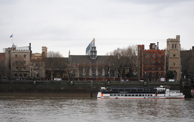
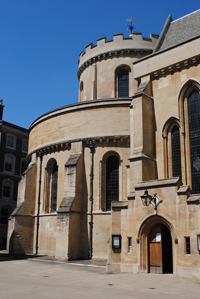
The first was in Holborn, located between the northern end of Chancery Lane and Staple Inn, and was known as the ‘Old Temple’ after which, in the latter years of the 12th century, the Templars moved their headquarters to the new site – ‘New Temple’ or Novum Templum – on unoccupied land on the bank of the River Thames. 

This new precinct included consecrated and unconsecrated areas. The consecrated part was a monastery and was located around what is now Church Court with the monastic refectory built on the site of what is now Inner Temple Hall – the medieval buttery is the only part of the original building which survives.

The lay or unconsecrated part of the precinct lay east of Middle Temple Lane, where a second hall was built on the site of what is now the Middle Temple Hall (you’ll find more on that here) which was used to house the lay followers of the order.

The original buildings also included the still existing Templar Church (pictured, along with a monument depicting the Templars outside the church), which was consecrated in 1185 during the reign of King Henry II by Heraclius, the Patriarch of Jerusalem, on a visit to London. Like all other Templar churches, its circular design was based on the design of the Church of the Holy Sepulchre in Jerusalem (the chancel was added later and consecrated in the presence of King Henry III in 1240 – for more on the Temple Church, you can see our earlier post here.

The New Temple become an important site in London (and the kingdom as a whole – the Masters of the Temple were the heads of the order in England) and was used by many of the nobility as a treasury to store valuables (and to lend money). It also had close connections with the monarchy and was, as we saw earlier this week, a power base for King John and from where he issued what is known as the King John Charter in 1215. He also used it for a time as a repository for the Crown jewels.

In an indication of the Temple’s prominence in state affairs, some of the great and powerful were buried here during this period including William Marshal, 1st Earl of Pembroke, who died in 1219, and his sons William and Gilbert (for more on those buried in the Temple, see our earlier post here). There were also apparently plans to bury King Henry III and his Queen here – this apparently spurred on the building of the chancel on the church – but they were eventually buried in Westminster Abbey instead.

Numerous relics were also apparently housed here during the Templar times including a phial believed to contain Christ’s blood and pieces of the true Cross.

The Templar era came to an end in 1312 when the order was dissolved on the authority of Pope Clement V amid some heinous allegations of blasphemy and sexual immorality which had the support of King Philip IV of France. While the pope awarded their property to the rival order, the Knights of the Hospital of St John of Jerusalem (also known as the Hospitallers), King Edward II had other ideas and ignored their claims with regard to the London property and instead, claimed it for the Crown (a dispute which went on for some years).

It later became associated particularly with lawyers, although lawyers would have certainly been at work in the New Temple given its role as banker to the wealthy (but more on its later associations with lawyers in later post).

For more on the history of the Templars, see Malcolm Barber’s The New Knighthood: A History of the Order of the Temple.

London Pub Signs – The Knights Templar…

The-Knights-Templar

Located in a former bank at the corner of Chancery Lane and Carey Street, this pub takes its name from the Crusader order known as the Knights Templar who once owned the land upon which the lane was constructed.

The Knights Templar was founded in Jerusalem in 1118 to protect Christian pilgrims and took its name from the Temple of Solomon upon the remains of which its headquarters in Jerusalem was built.

The order arrived in London later that century and Chancery Lane was created to connect the site of their original headquarters in Holborn with their subsequent home which lay between Fleet Street and the Thames – with the latter centred on a chapel (consecrated in 1185) which still stands and is now known as the Temple Church.

The pub, which opened in 1999, was formerly the home of the Union Bank of London Ltd, built in 1865 to the design of architect FW Porter.

Original features inside the Grade II-listed building – built in the ‘high Renaissance’-style – include cast iron columns and ornate detailing.

It is now part of the Wetherspoon’s chain. For more information, see www.jdwetherspoon.co.uk/home/pubs/the-knights-templar-chancery-lane.


What’s in a name?…Lambeth…

LambethThe origins of the Thames-side district Lambeth’s name are not as obscure as it might at first seem.

First recorded in the 11th century, the second part of the name – which apparently is related to/a derivative of the word ‘hithe’ or ‘hythe’ – means a riverside landing place while the first part of the name is exactly what it seems – ‘lamb’. Hence, Lambeth was a riverside landing or shipping place for lambs and cattle.

There has apparently been a suggestion in the past that the word ‘lamb’ actually derived from an Old English word meaning muddy place, hence the meaning was ‘muddy landing place’. That theory, however, is now generally discounted.

Lambeth these days is still somewhat in the shadow of the much more famous Westminster river bank opposite but among its attractions is the Imperial War Museum (located in the former Bethlem Hospital, see our earlier post here), Lambeth Palace (pictured above) – London residence of the Archbishop of Canterbury, and, of course, the promenade of Albert Embankment (sitting opposite Victoria Embankment).

The headquarters of MI6 is also located here in a 1994 building designed by Terry Farrell (among its claims to fame is its appearance in the opening scenes of the James Bond film, The World Is Not Enough).

Lambeth – the name is also that of the borough in which the district is located – was formerly home to the Vauxhall Pleasure Gardens which closed in the mid 19th century (see our earlier post here).

London Pub Signs – The George and Devonshire…

The-George-and-Devonshire

The last remaining pub in old Chiswick village in west London, The George and Devonshire has a history dating back to the 1650s.

The-George-and-Devonshire2Initially known simply as The George (like so many taverns and pubs, apparently after England’s patron saint), by the 1820s the name had changed to The George and Devonshire – the Duke of Devonshire’s former showpiece property, Chiswick House, can still be found nearby (for more on Chiswick House, see our earlier post here). The coat of arms of the Dukes of Devonshire now hang over the door.

The Grade II-listed building at 8 Burlington Lane, which is conveniently located just metres from a Fullers brewery, dates from the 18th century.

There was apparently once a secret passageway which led from the pub under the nearby St Nicholas’ Church (burial place of artist William Hogarth) to an opening located among a group of small cottages near the Thames – it is said to have been used by rum and spirits smugglers in the 1700s. The remains of the entrance can still apparently be seen in the pub’s cellar.

For more, see www.georgeanddevonshire.co.uk.

Lost London – Alsatia…

A Thames-side slum area located between Temple and Whitefriars Street (and south of Fleet Street), an area previously occupied by the Whitefriars Monastery, Alsatia was known as something of a lawless district where residents resisted any intervention by City officials.

The district came into existence following the dissolution of the monastery by King Henry VIII (he apparently gave the buildings and land to his physician Dr William Butts) and the area, despite some initial efforts to build substantial houses there, eventually degenerated into an overcrowded slum (apparently even when the priory was still existent, some of the surrounding areas had been somewhat disreputable).

The right of sanctuary apparently existed in the area which meant that debtors and criminals who entered gained immunity from arrest while they remained here.

Authorities were certainly loathe to enter the district given the strength which residents showed in resisting any attempts to grab hold of wanted persons and the maze-like narrow thoroughfares of the area and it became mockingly referred to as Alsatia in a reference to Alsace, a much disputed region on the French-German border which was historically outside normal legal jurisdiction.

Among those who took refuge here was Daniel Defoe – he is said to escaped here in 1692 after he was wanted by authorities for writing seditious material.

There were several attempts to clean up the slum but these had little effect (although the Great Fire of London did burn through here in 1666) and in 1608, King James I confirmed the area’s liberties in a formal charter. The rights remained in place until 1697 when they were abolished by an Act of Parliament (along with those of other liberties), although the area maintained its disreputable character for some time after.

Alsatia was mentioned in several books including in Thomas Shadwell’s 1688 play The Square of Alsatia and Sir Walter Scott’s 1822 novel, The Fortunes of Nigel, and the term continued to be used to refer to run-down neighbourhoods until late in the 19th century.