• Join the Georgian Queen Caroline for a garden party in the grounds of Kensington Palace this weekend. The Georgian Court will be taking to the palace gardens for a summer celebration featuring music, military drills and theatre as they bring the era to life. Visitors are encouraged to immerse themselves in the experience as a courtier with the gardens decked out in a range of tents where they can try out costumes and powdered wigs as well as learn court etiquette, swordplay and dancing while the ice-house will feature Georgian ice-cream (and it’s rather odd flavours such as parmesan). Runs from tomorrow until Sunday. Admission charges apply (under 16s go free with a maximum of six children per paying adult). For more, see www.hrp.org.uk/KensingtonPalace/. PICTURE: ©Historic Royal Palaces
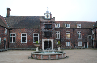
• First created in 1923, a playground in Victoria Tower Gardens – newly named the Horseferry Playground – has been reopened after improvement works. The works, carried out under the management of Royal Parks, have seen the reintroduction of a sandpit as well as the installation of new swings and slide, dance chimes and a stare play installation to represent the River Thames. The playground, located close to the Houses of Parliament in Westminster, also features a series of timber horse sculptures, new seating and a refreshment kiosk with metal railings designed by artist Chris Campbell depicting events such as the Great Fire of London and Lord Nelson’s funeral barge and views of the River Thames. The project has also seen the Spicer Memorial, commemorating role of paper merchant and philanthropist Henry Spicer in the establishment of the playground – then just a large sandpit, restored. For more, see www.royalparks.org.uk/parks/victoria-tower-gardens.
• Now On – A Dickens Whodunnit: Solving the Mystery of Edwin Drood. This temporary exhibition at the Charles Dickens Museum in Bloomsbury explores the legacy of Dickens’ final novel The Mystery of Edwin Drood, left unfinished after his death in 1870. Visitors are able to investigate crime scenes, search for murder clues and see the table on which the novel was penned as well as clips from theatrical adaptations, and a wealth of theories on ‘whodunit’. The exhibition runs until 11th November. Admission charge applies. For more, see www.dickensmuseum.com.
Send all items for inclusion to exploringlondon@gmail.com.


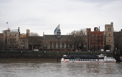
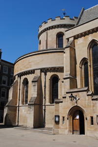 The first was in Holborn, located between the northern end of Chancery Lane and Staple Inn, and was known as the ‘Old Temple’ after which, in the latter years of the 12th century, the Templars moved their headquarters to the new site – ‘New Temple’ or